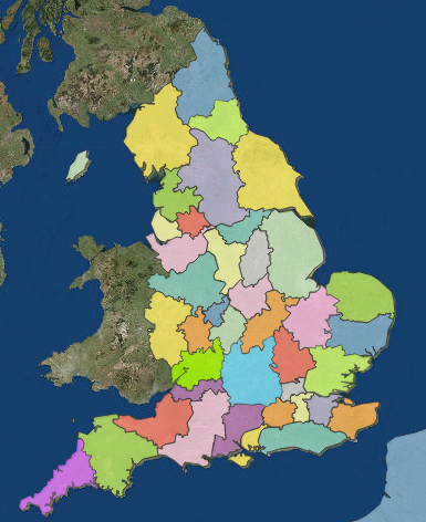
The Research and Statistics unit of the Church of England has produced an interactive Church of England parish map, with summary deprivation and census statistics mapped onto parish boundaries.
These will not necessarily be exactly the same as the parish your ancestor inhabited but will be a guide.
The statistic of deprivation is particularly interesting as it rarely changes dramatically.
The map is for England, not for other parts of the UK nor the Anglican community elsewhere.
The drop in adherents to the Church of England is dramatically shown in a Statistics of Mission report also produced by the Research and Statistics Unit.
Since 2006, Canada's Anglo-Celtic Connections has been an independent view of family history resources and developments seen from an Ottawa perspective.
Search This Blog

Genealogy Tweets
Links
Subscribe via email
Blog Archive
-
▼
2018
(925)
-
▼
February
(66)
- RootsTech Discounts
- A Red Letter Day for Genealogy at LAC and OPL
- British Newspaper Archive additions for February
- Family Tree March 2018
- And After - The Consequences of World War I
- OGS March Webinar: Irene Robillard
- Damned Immigrants
- Awards for Grandchildren
- Gene-o-Rama 2018
- OGS Conference Early Bird Discount Deadline is 28 ...
- Survey Results: likely and unlikely in genealogy
- Findmypast adds to Derbyshire Record Transcriptions
- New Worcestershire & Kent records from Ancestry
- Buckinghamshire Colour Tithe Maps
- The SNP Mess
- Ancestry adds Liverpool Electoral Registers, 1832-...
- OGS Ottawa Branch February Meeting
- UHF Day in Ottawa
- Local newspapers from LAC
- "In the Footsteps of our Irish Palatine Ancestors"...
- Historical Society of Ottawa February Meeting
- City of Victoria Archives Online Search
- Free access to Ancestry.co.uk records
- GGI Belfast 2018
- FreeBMD February Update
- Recognition for Paul Milner
- Findmypast adds Yorkshire Parish Records
- Open access to Canadian Immigration Records from A...
- Quinte Branch OGS February Meeting
- Ancestry adds London Directories 1736-1943
- New Irish Genealogical Research Society Videos
- BIFHSGO Scottish SIG
- Kingston Branch OGS February Meeting
- New articles from the JG&FH
- CEF Service Files Update for February 2018
- QFHS Conference 2018
- I vow to thee: Centenary of the Death of Sir Cecil...
- RootsTech Streaming Schedule
- MyHeritage Valentine's Day
- OntarioFamilyHistory.org
- Perth & District Historical Society February Meeting
- Cheddar Man changes the way we think about our anc...
- Survey: likely and unlikely in genealogy
- Tipperary Resources
- The Genealogist adds over 650,000 criminal records
- Findmypast adds to Devon parish records
- DNA: tracing your ancestors and your genealogy
- Church of England Modern Parish Maps and Information
- Digital reconstruction of Irish Public Record Office
- BIFHSGO February Meeting
- Seven Million AncestryDNA Customers
- On the Road in Ireland
- Findmypast adds two Durham Diocese browse collections
- Votes for Women
- What is PERSI and How Can You Use it to Improve Yo...
- Home Child Bonuses
- "Comparing the Genealogy Giants: Ancestry, FamilyS...
- Where to find Cornwall Parish Records Online
- No.1 Canadian Casualty Clearing Station Transcript...
- Were Canada's Home Children Orphans?
- Voilà – Canada’s new National Union Library Catalogue
- Tracing your Irish and Scots-Irish Ancestors
- MyHeritage DNA Advances
- Twice as many Home Children were in Good placement...
- Ancestry adds Wiltshire, England, Wills and Probat...
- Internet Genealogy Feb/Mar 2018
-
▼
February
(66)

3 comments:
John,
This is interesting but I wonder what deprivation actually means. I couldn't find a definition on the site. It would appear to be a government statistic rather than a church statistic. It appears, from observation of Kent and West Cumbria parishes that the urban, or older industrial areas seem to be the most deprived. Ironically some of these remote areas in Cumbria are the least deprived areas when it comes to education. There is lots of data on this site but some more explanatory information would have been helpful.
Paul Milner
http://anglo-celtic-connections.blogspot.ie/2015/10/english-indices-of-deprivation.html?m=1 and the sources will be helpful for deprivation.
Hi John:
Not sure if you are aware of 'Parish Locator', a freeware programme available at http://www.benynet.co.uk/ParLocDL.html
which I have been using for about 15 years to locate parishes in England.
I have found it extremely useful.
Regards,
Ian Barker
Post a Comment